

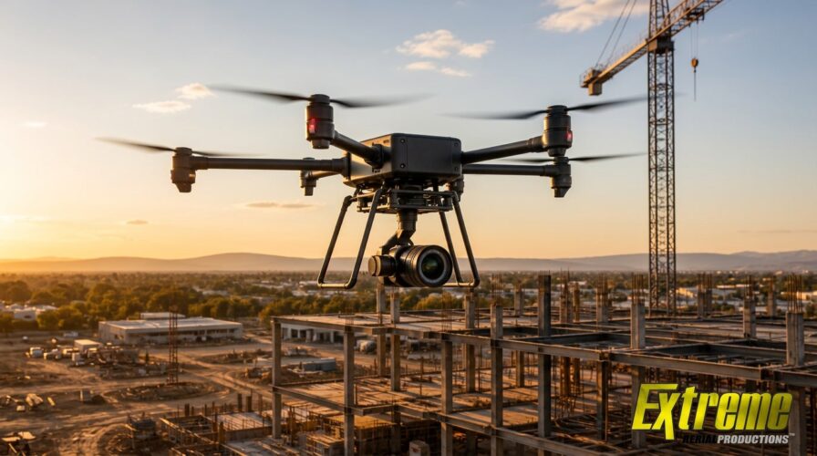
Construction and development teams do not need aerial content that merely looks impressive. They need information they can use. When a site is active, expensive, and constantly changing, a pretty overhead image only goes so far.
Teams need to see progress, document conditions, inspect hard-to-reach areas, understand terrain, and share project updates with people who may never step onto the site. That requires aerial data with accuracy, context, and a professional workflow behind it.
Extreme Aerial Productions helps construction and development clients approach drone services from that practical angle. The FAA-certified drone company provides aerial photography, LiDAR, photogrammetry, TOPOs, mapping, roof inspections, and site documentation for projects that need more than a basic flyover.
The goal is simple: give teams better information from above so they can make better decisions on the ground.
Aerial Data Helps Teams See the Site More Completely
A construction site can be difficult to understand from ground level. Crews, equipment, materials, access points, grading, structures, and surrounding conditions are all moving pieces. Even experienced project teams can lose perspective when they are working inside the site every day.
Professional drone services give teams a wider view without pulling attention away from the work itself. Aerial imagery can show layout, progress, staging areas, material placement, site access, surrounding properties, and visible changes over time.
Extreme Aerial Productions uses drone photography and aerial documentation to help clients capture that broader perspective. For developers, builders, contractors, and property teams, this can make project conversations easier and more productive.
Aerial data is especially useful when stakeholders are spread across different locations. Instead of relying only on written updates or isolated ground photos, teams can review visual records that show how the site is actually developing.
That can help owners, investors, project managers, engineers, and marketing teams stay aligned without turning every update into a game of interpretive paperwork.
LiDAR and Photogrammetry Add Technical Depth
Some projects need more than visual documentation. They need measurements, models, maps, and datasets that can support planning, design, construction, or development conversations.
Extreme Aerial Productions offers LiDAR and photogrammetry services for clients that need detailed aerial data. These tools can help capture site conditions in ways that standard photography cannot fully provide.
LiDAR uses laser-based scanning to collect spatial information, which can support detailed terrain and structure documentation. Photogrammetry uses overlapping images to create maps, models, and measurable visual outputs when captured and processed correctly.
For construction and development teams, these services can help with topographical documentation, site analysis, project records, and workflows that support planning, design, and construction discussions. They can also support communication between teams that need a shared understanding of the physical environment.
The advantage comes from matching the right method to the right project. A simple marketing image, a roof inspection, a progress update, and a LiDAR deliverable all require different planning. Extreme Aerial Productions gives clients access to a broader aerial toolkit that allows each project to be planned around the right capture method.
Better Documentation Reduces Guesswork
Progress documentation is one of the strongest uses of drone services for construction and development. When captured consistently, aerial records can help teams compare current conditions with previous stages, review visible changes, and communicate updates more clearly.
Construction projects create a constant stream of decisions. Teams need to know what has changed, what is ready, what still needs attention, and what may affect the next stage of work.
Extreme Aerial Productions can help clients document sites from above so project teams have visual records that are easier to review and share. This does not replace field expertise, engineering review, or site management, but it can strengthen the information available to those teams.
Aerial documentation can also support accountability. When teams can see the site from a consistent perspective, it becomes easier to discuss progress without relying only on memory, scattered photos, or long update chains.
For developers and builders, that kind of record can support smoother communication with clients, partners, internal teams, and outside stakeholders.
Roof Inspections Become Safer and More Practical
Roof inspections are another area where aerial services can create practical value. Roof access can involve safety concerns, scheduling issues, and physical limitations, especially for larger properties, steep structures, commercial buildings, or hard-to-reach areas.
Extreme Aerial Productions offers roof inspection services that allow clients to document visible roof conditions from above. Drone-based inspection imagery can help property owners, contractors, developers, and facility teams review areas that may be difficult or risky to access manually.
This approach can make the inspection process more efficient while reducing unnecessary exposure to physical hazards. It can also give teams visual records that are easier to store, compare, and share.
A drone inspection should be handled by a professional operator or crew that understands both the flight environment and the purpose of the inspection. Clear imagery, appropriate angles, proper planning, and safe operations all affect the usefulness of the final output.
That is where Extreme Aerial Productions brings more value than a casual drone operator. The company combines flight capability with a professional approach focused on producing usable results.
Compliance and Safety Strengthen the Workflow
Construction and development sites are not casual environments. Drone operators entering these spaces need to understand risk, coordination, safety expectations, and regulatory requirements.
Extreme Aerial Productions supports that need through FAA 333/107 approvals, commercial UAV aviation insurance, OSHA 30 certification, and MSHA certification. Those credentials are meaningful for clients that need aerial work performed in professional, regulated, or safety-conscious environments.
For construction teams, compliance is not a nice extra. A drone flight can involve airspace restrictions, site hazards, people, equipment, nearby structures, and privacy considerations. A professional drone company should be able to address those concerns before the project begins.
Extreme Aerial Productions gives clients a stronger foundation by treating legal and safety requirements as part of the work. That helps reduce the risk of preventable problems and gives project teams more confidence in the process behind the deliverables.
The final aerial data may be the visible product, but the planning behind it is what helps protect the project.
Aerial Data Can Support Both Operations and Marketing
Construction and development teams often need aerial media for more than one purpose. The same project may require technical documentation, internal updates, investor materials, public-facing visuals, and marketing assets.
Extreme Aerial Productions is well positioned for that overlap because its services include technical aerial data and high-quality visual production. A development team may need progress documentation for internal review while also needing polished aerial photography for sales, leasing, or promotional use.
This dual capability can make the workflow more efficient. Instead of treating technical documentation and visual storytelling as separate needs, clients can work with a drone company that understands both sides.
For developers, aerial views can show location, scale, access, surrounding growth, and the overall presence of a project. Those visuals can help communicate value to buyers, tenants, investors, or community stakeholders.
For construction teams, aerial documentation can help show progress in a way that feels organized and credible. The footage does not have to be overly dramatic to be persuasive. It simply has to show the project well.
The Right Drone Partner Makes the Data Easier to Use
Drone services create the most value when the deliverables match the project’s actual needs. A team that needs LiDAR should not receive only attractive still images. A developer preparing marketing assets should not receive raw footage without a clear visual direction. A roof inspection should not be planned like a cinematic flyover.
Extreme Aerial Productions helps clients avoid that mismatch by offering a broad range of aerial services under one professional operation. The company can support drone photography, real estate imaging, construction documentation, roof inspections, LiDAR, photogrammetry, TOPOs, mapping, and production work.
That range helps clients start with the right question: what does the aerial data need to accomplish?
For some projects, the answer is documentation. For others, it is measurement, inspection, progress visibility, stakeholder communication, or marketing impact. Once the goal is clear, the aerial workflow can be built around the right capture method and deliverable.
That is the difference between collecting footage and creating useful aerial information.
Build Better Project Decisions From Above
Construction and development projects carry too many moving parts for weak documentation. Teams need aerial information that is accurate enough to support discussion, clear enough to share, and professional enough to reflect the scale of the work.
Extreme Aerial Productions gives construction and development clients a stronger way to capture that information. Its FAA-certified drone services, LiDAR, photogrammetry, TOPOs, roof inspections, aerial photography, mapping, and site documentation help teams see projects from a better vantage point.
For teams planning a build, development, inspection, or site documentation package, the next step should be practical. Define what the aerial data needs to show, who needs to use it, and what decisions it should support.
Then bring that project scope to Extreme Aerial Productions and build the drone service around the outcome, not just the flight.